 March 18, 2025
Maps Now Available for Enterprise
Enterprise customers can access mapping tools to visualize location data
What's New?
Enterprise Unlimited customers can now enable our Maps feature.
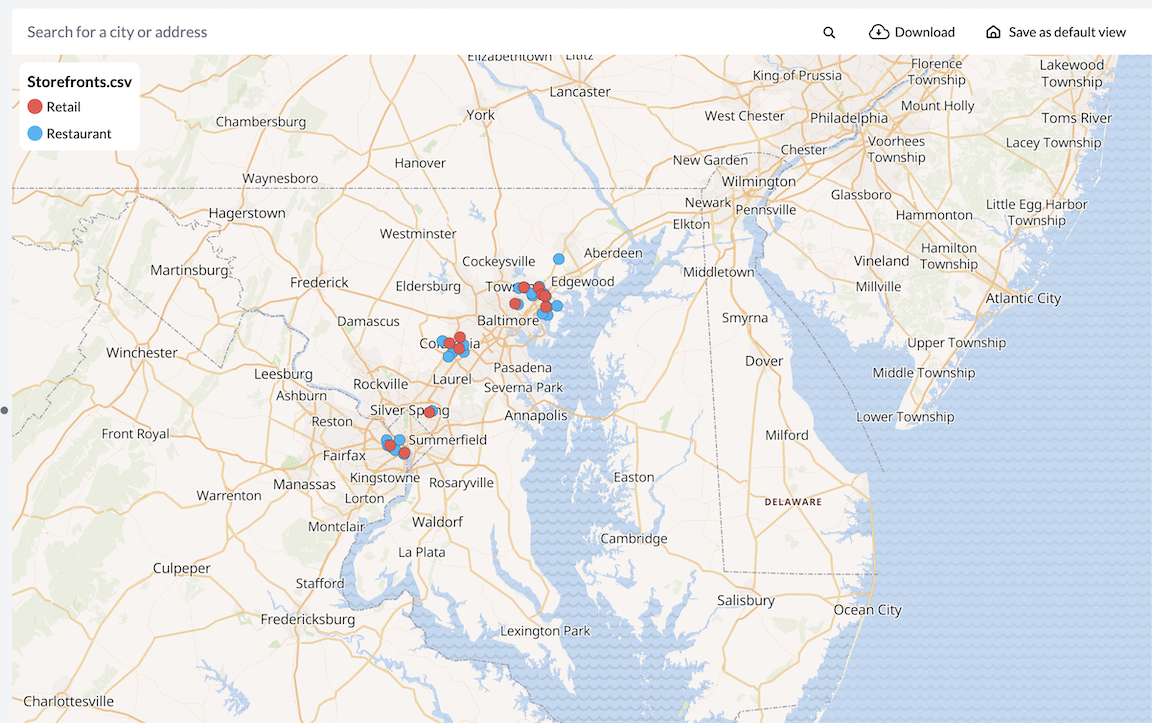
Maps is an easy-to-use addition to your account dashboard that allows you to visualize the addresses or coordinates in your spreadsheets as markers on a map. You can style and customize these markers using different icons and colors, as well as add pop-up descriptors that activate on click.
Maps are included with your subscription and do not have an additional cost.
Enabling Maps
Only account administrators can enable Maps.
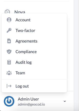
To enable Maps for your account, log in to the Geocodio Enterprise dashboard. Then, look at the lower left-hand corner and click on your name and email address to open up the menu. Select the "Team" tab.
Once you get to the Team page, you'll find a section called "Team settings." Here, you can enable Maps. Click the "Enable" button and the Maps tab will be added to your account dashboard automatically.

If there are any team members associated with your Enterprise account, they will also be able to access Maps as well. Please be aware that this is a permanent change.
Creating Maps
Maps can be created using any spreadsheet that has less than 100,000 rows. Navigate to the new "Maps" tab on your account dashboard and select the "Create Map" button to get started.

For more detailed guidance on how to create and customize maps, please see our tutorials here.
Sharing Maps
By default, all maps are private. However, it is possible to share the maps you create. Since our Enterprise customers are often working with PHI or other sensitive data, this must be manually permitted by the admin.
Once you've enabled Maps, another setting will be added to the Team settings section: "Allow Public Maps."
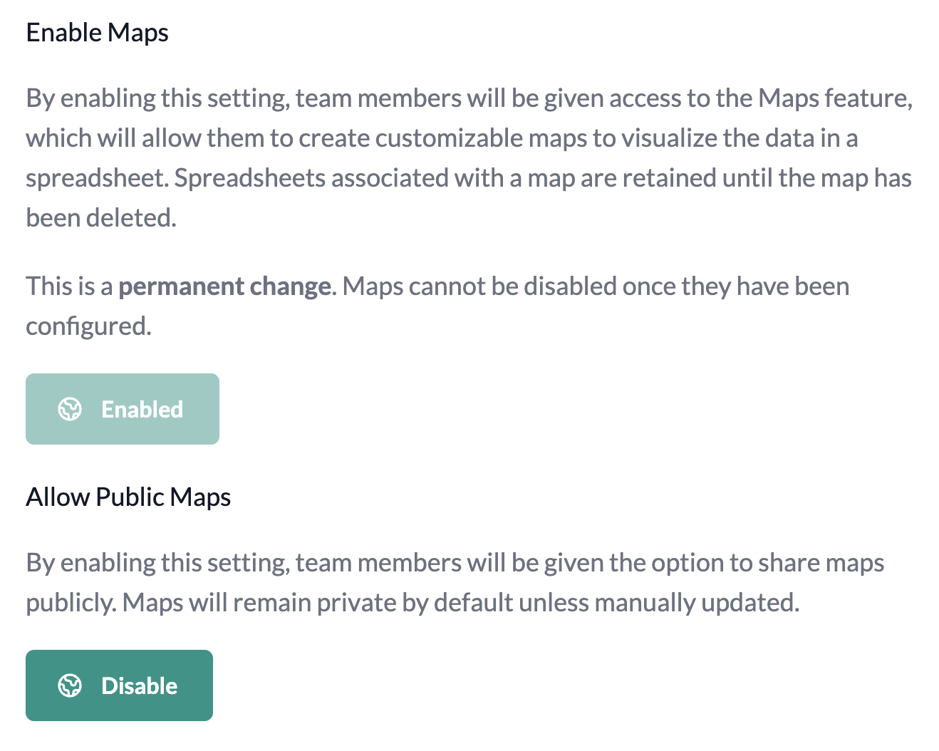
When you allow public maps, the admin and any team members will have the ability to share and embed the maps they create. This option can be disabled at any time.
Even once this has been selected, maps remain private by default and sharing settings must be manually changed before they can be shared. You will be asked to confirm any attempt to share a map before proceeding.

Data Retention
Typically, Enterprise spreadsheet uploads are only retained for 72 hours before being automatically deleted. Please be aware that if you choose to make a map using a spreadsheet, we will retain that spreadsheet until the map has been deleted.
Questions
If you have any questions about Maps for your Enterprise account, please reach out to us at support@geocod.io and we'll be happy to help.
About Geocodio Enterprise
Geocodio Enterprise is a geocoding and data matching SaaS for the US and Canada built to meet the requirements of SOC 2 Type 2 and HIPAA. Geocodio is designed for bulk geocoding, and supports customers who need to geocode millions of addresses or coordinates — per year, month, day, or hour. Geocodio also simplifies your ETL by allowing you to add additional data in the same request, such as Census boundaries, political districts, and more. Geocodio Enterprise is used by a wide variety of companies with the highest data handling and privacy requirements, including major health insurers, financial services firms such banks and brokers, e-commerce companies, and more.